
The 12er Peaks
The 12 mountains of the Taconic 12er Challenge have been strategically chosen for their regional significance, hiker accessibility and scenic nature. They provide excellent representation of the three geographical and cultural regions of the Taconic Range- the Northern, Central, and Southern Taconics. There are 5 peaks in Massachusetts , 4 in Vermont, 2 in New York, and 1 in Connecticut.
Central Taconic Peaks
Southern Taconic Peaks
Northern Taconic Peaks


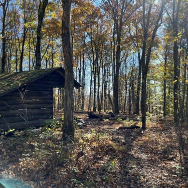
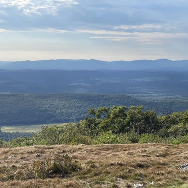
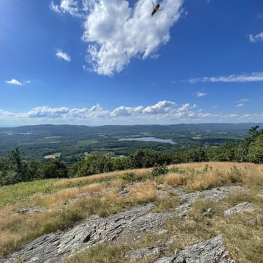
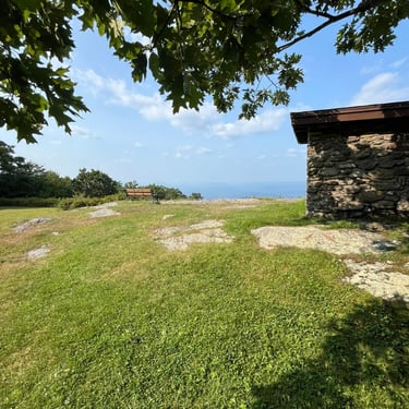
Alander Mountain (2,250 ft)
Mount Washington State Forest, Washington MA
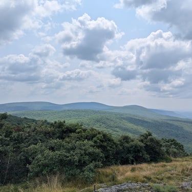
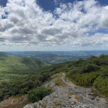
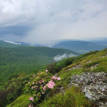
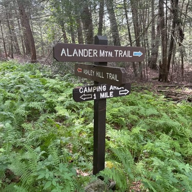
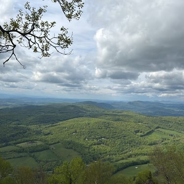
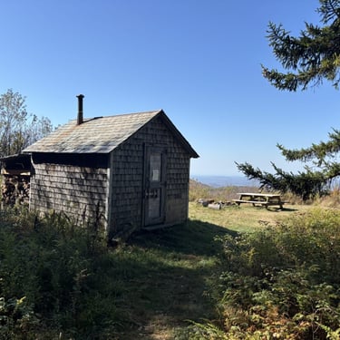
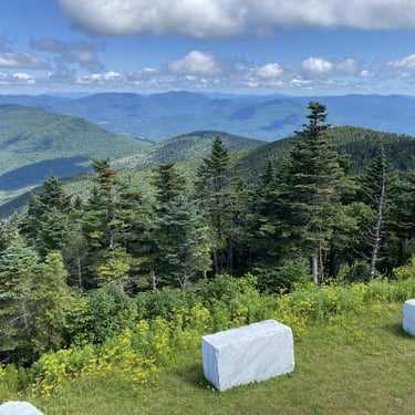
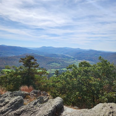
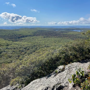
Alander Mountain offers stunning views of the Harlem Valley and area South Taconic peaks from its grassy, open summit. The mountain straddles the New York-Massachusetts border and can be climbed from both states. An extensive trail network connects neighboring parks and allows for hikes of many lengths, including side trips to other Taconic 12ers. It is a popular spot for backcountry camping, with well-appointed primitive sites and an old fire lookout cabin near the summit.
Resources
Special Considerations, Alerts
Park open dawn to dusk
Backcountry camping temporarily suspended
Antone Mountain (2,600 ft)
Merck Forest & Farmland Center, Rupert VT
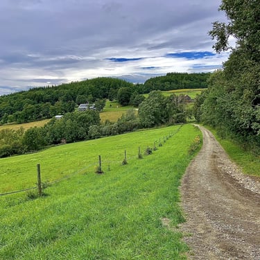
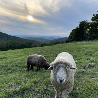
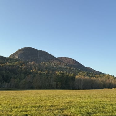
Antone Mountain resides within the wonderful Merck Forest & Farmland Center, a non-profit organization who's mission is to connect people to sustainable forestry and farming practices on their 3,500 acre property. The public is invited to explore their working farm, wander the trails, participate in workshops, and spend the night in one of their cozy cabins. A hike to Antone's summit passes through fields of grazing sheep, along blueberry patches, and through managed forest lands before arriving at a lovely vista overlooking the farm.
Suggested Hike
Special Considerations, Alerts
Private Property, visitors are welcome dawn to dusk.
Free Entry, donations welcome
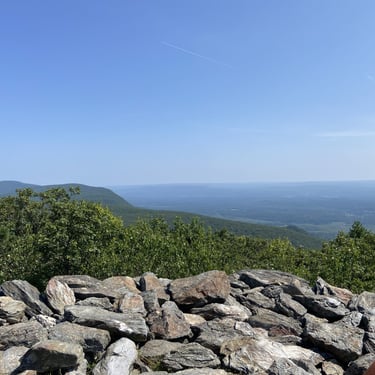
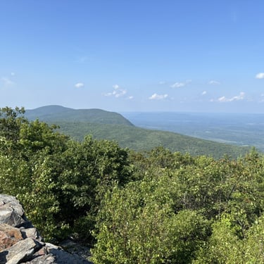
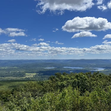
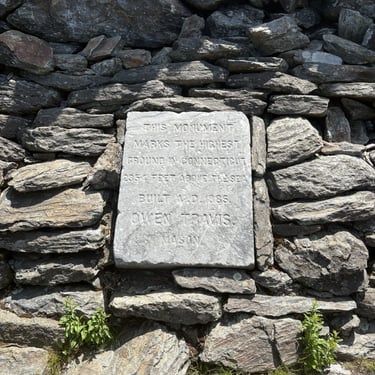
Bear Mountain (2,316 ft)
Appalachian National Scenic Trail, Salisbury CT
Bear Mountain is the highest peak that lies wholly within Connecticut (the south slope of nearby Mount Frissell is the state's true highpoint, but its summit is over the border in Massachusetts). It is a popular spot along the Appalachian Trail, which crosses over its rocky summit. The ruins of a stone monument and historic marker adorn the top, and from the summit one can enjoy expansive views of the Southern Taconic mountains.
Special Considerations, Alerts
None
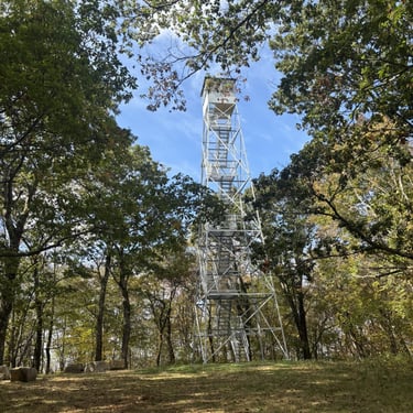
Beebe Hill (1,726ft)
Beebe Hill State Forest, Austerlitz NY
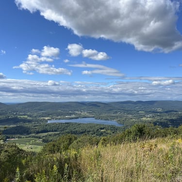
Beebe Hill offers hikers excellent 360 degree views thanks to a 60-foot tall fire lookout tower that sits on its summit. The tower once stood atop Alander Mountain, another 12er peak, before being moved to Beebe Hill in 1964. A short jaunt to the tower and its stellar panorama makes Beebe Hill one of the best bang-for-your-buck hikes in the Taconics. The state forest here is also a great for primitive camping and mountain biking.
Special Considerations, Alerts
All trails are multi-use
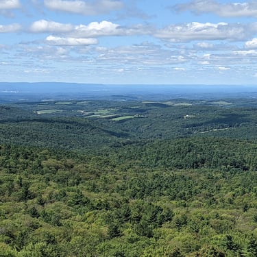
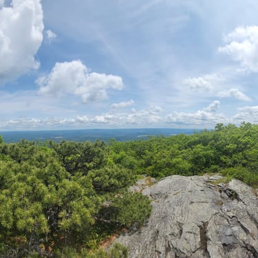
Brace Mountain (2,311 ft)
Taconic State Park, Millerton NY
Brace Mountain sits near the tri-point of New York, Connecticut, and Massachusetts, its summit just inside the NY line. Hikers can approach the mountain from each state using an extensive trail network. The New York approach is notoriously steep, while an approach from Massachusetts and Connecticut allow for lengthier hiking over nearby 12er peaks along the way. The Brace Mountain summit is wide open, with panoramic views west toward the Hudson Valley and Catskills. It is a popular launch spot for paragliders.


Special Considerations, Alerts
Limited Parking at Quarry Hill Trailhead.
Equinox Mountain (3,840 ft)
Equinox Preservation Trust, Manchester VT
Equinox Mountain (aka Mt. Equinox) is the tallest peak in the Taconic Range. It's an impressive and imposing mountain, rising over 3000 ft from the valley below. Much of Equinox, including the summit, is privately owned. A Carthusian monastery sits tucked away on the mountain, and a paved toll road allows visitors the opportunity to drive winding and scenic slopes to the summit. From the summit observation deck, there are 360 views of the Taconics, Green Mountains, Adirondacks, and White Mountains. Hikers can enjoy a challenging, no-fee jaunt to the summit on foot thanks to the work of the Equinox Preservation Trust, which protects the forest of the mountain's eastern slope and maintains a network of trails for public use.
Special Considerations, Alerts
Driving to the summit, while certainly worth doing, does not count for the Taconic 12er Hiking Challenge
Trails of the Equinox Preservation Trust may close during mud season.
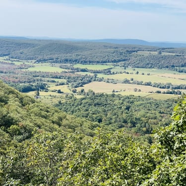
Haystack Mountain (1,919 ft)
North Pawlet Hills Natural Area, Pawlet VT
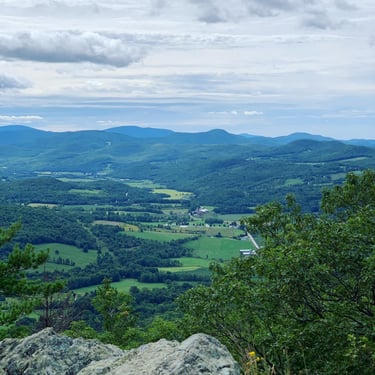
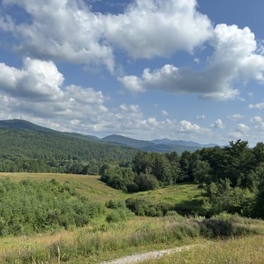
Haystack Mountain is a gem of the northern Taconic mountains, its distinctive cliffs looming over the farmlands of the Mettowee Valley among a sea of rolling, forested hills. Visitors can enjoy 360 degree views from Haystack's rocky outcroppings. The preservation of this striking mountain is the result of a joint effort: The Nature Conservancy protects the ecologically important forestland around the mountain, while the local nonprofit Friends of Haystack protect the land of its craggy summit for public use.
Special Considerations, Alerts
Dogs are NOT permitted at this natural area
Extremely limited parking. Groups should consider carpooling
Hike starts on private road, be respectful of all posted signs
There are several mountains named "Haystack" in Vermont. Make sure you're hiking the one in the North Pawlet Hills!
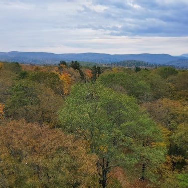
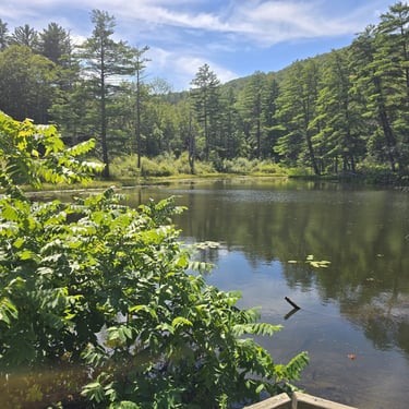
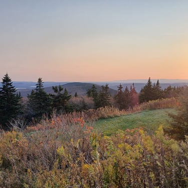
Lenox Mountain (2,146 ft)
Pleasant Valley Wildlife Sanctuary, Lenox MA
Lenox Mountain is the highpoint along a broad 10-mile massif of the the Taconic Mountains known as Yokun Ridge. There are wonderful panoramic views from the open, grassy summit of Lenox Mountain. The Richmond Fire Tower also resides at the top, but it is closed to the public. Many vistas punctuate the rest of Yokun Ridge- a patchwork of preserves and private lands- and are worth exploring. Hikers starting from the Pleasant Valley Wildlife Sanctuary can also enjoy wandering the diverse wetlands and meadows at the base of the massif before climbing Lenox Mountain's steep eastern slopes.
Special Considerations, Alerts
Pleasant Valley Wildlife Sanctuary charges a small fee to enter
Dogs are NOT permitted on Sanctuary lands
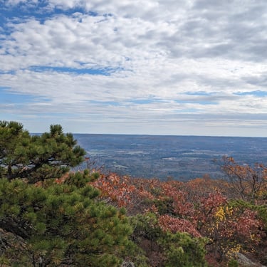
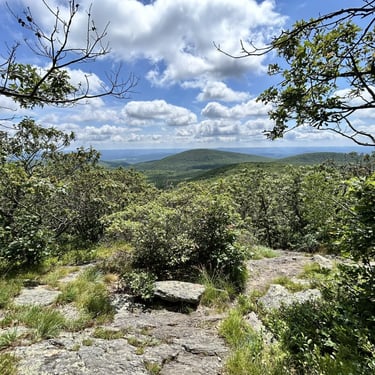
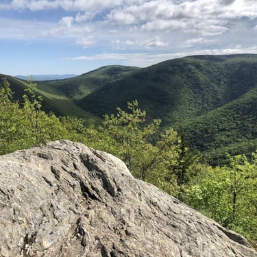
Mount Everett (2,602 ft)
Mount Everett State Reservation, Mt. Washington MA
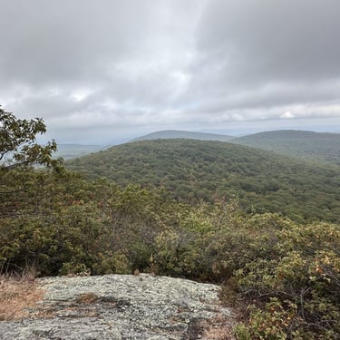
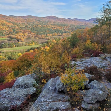
Mount Everett is the highest peak in the Southern Region of the Taconic Mountains, and its prominent domed shape is easy to spot. It's rocky summit area, fully exposed to the harsh New England weather, can only support a stunted grove of pitch pines and scrub oak. Consequently, views are excellent above this fragile, dwarf forest. The Appalachian Trail climbs over Mount Everett from the north and south, and side trails provide additional access from the mountain's eastern and western slopes. It's neighbor peak, Mountain Race, has a phenomenal ridgeline, and the additional views are worth a side trip.
Special Considerations, Alerts
No overnight parking at Reservation
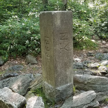
Mount Frissell (2,454 ft)
Mount Washington State Forest, Mt. Washington MA
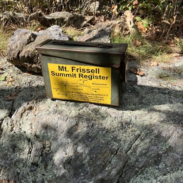
Mount Frissell straddles the Massachusetts and Connecticut border. Its summit sits on the MA side, and where its south slope crosses the state line is the highest natural point in CT at 2,380 ft. The NY-MA-CT tri-state point marker is nearby. While the actual summit of Frissell is wooded, there are excellent views from its southern slope just a short walk away. Its eastern neighbor, Round Mountain, has great views and is typically climbed en route to Frissell. Brace Mountain to the West, another 12er peak, is also a scenic add-on to a Frissell outing.
Resources
Special Considerations, Alerts
None
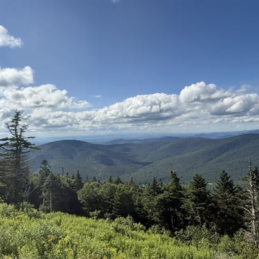
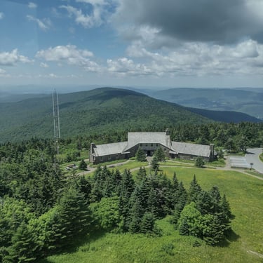
Mount Greylock (3,491 ft)
Mount Greylock State Reservation, Adams MA
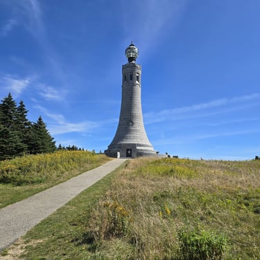
Mount Greylock is the highest peak in Massachusetts. It sits at the center of the 11-mile long Greylock Range massif, which towers above the Hoosic Valley. Greylock's sub-alpine summit offers expansive views, and climbing the iconic Veterans War Memorial Tower at the top affords 90+ mile sights in all directions on a clear day. A seasonal auto road allows visitors easy access to the upper mountain, while the summit Bascom Lodge offers a unique opportunity to dine in or spend the night. For the adventurer, hiking, and camping opportunities abound. The Appalachian Trail traces the entire ridge, and the wilderness park boasts over 70 miles of trail to explore.
Special Considerations, Alerts
Driving to the summit does not count for the Taconic 12er Hiking Challenge
Auto Road, Memorial Tower, and Bascom Lodge open seasonally, weather permitting
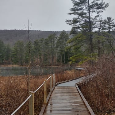
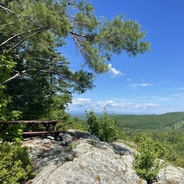
Zion Hill (2,454 ft)
Taconic Mountains Ramble State Park, Hubbardton VT
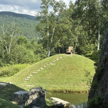
Zion Hill (also Mount Zion Major) is a mini-mountain in the low, rolling hills of the Northern Taconic Mountains. It resides in Vermont's newest, and perhaps most unique, state park. The land was bequeathed to the state under a trust by the filmmaker Carson Davidson in 2016, and it includes several miles of scenic trails, rolling meadows, and a picturesque Japanese garden. A hike of Zion Hill is short, but strenuous and requires some scrambling. A picnic bench at the overlook makes for a wonderful stop. For more views, add in the Mount Zion Minor and Moot Point vistas to your hike. Leave time to relax in the garden and meander the wildflower meadow paths.
Resources
Special Considerations, Alerts
Park is day-use only with no visitor facilities
Gardens maintained Memorial Day Weekend - mid-October

2026 Taconic 12er Challenge. All Rights Reserved.
Happy Trails!
Taconic 12er Challenge
Connect
Challenge yourself to hike twelve scenic peaks in the beautiful Taconic Mountains region and earn an exclusive finisher patch!


Quick Links